
Reviewed · HIKING & TREKKING
Hiking in the Sierra Norte of Oaxaca
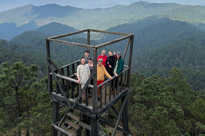
High mountains, hearty food, and fresh air await. This full-day outing from Oaxaca City takes you into the Sierra Norte, where pine-oak forest, rocky trails, village restaurants, and changing microclimates replace the city’s heat and traffic. I especially like the combination of local food and mountain hiking, plus the chance to learn about native plants, wildlife, and fungi from guide Luis Fernando.
The main caution is that this is a real mountain hike, not a gentle woodland stroll. The altitude reaches about 2,800 to 3,100 meters, and the first available section may feel challenging, especially if you live near sea level or arrive in Oaxaca without time to adjust.
In This Review
- Key points to know before booking
- From Oaxaca City to Cuajimoloyas at 8 a.m.
- A local breakfast in Cuajimoloyas
- Starting the trail near Benito Juárez
- Pine, oak, fungi, and changing microclimates
- Views that reward the climbs
- How Luis Fernando handles different abilities
- Dinner, trout, and mountain-town hospitality
- What to bring for the Sierra Norte
- Is $161.30 a good value?
- Who should book this Oaxaca hiking day?
- Should you book Hiking in the Sierra Norte?
- FAQ
- Where does the experience begin?
- How long does the experience last?
- How far is the hike?
- How high does the hike go?
- What meals are included?
- What should I bring?
- How large is the group?
Key points to know before booking
- Breakfast comes before the hike: You stop in Cuajimoloyas for a substantial local meal, so come hungry.
- The route changes to fit the group: Options are described as short, intermediate, or long, ranging from 2 to 25 kilometers.
- Expect steep ground: Several sections rise and fall sharply, with little flat walking.
- Luis Fernando is a major strength: He explains local plants, mushrooms, wildlife, and traditional uses in clear English.
- You reach high altitude: The forest sits between 2,800 and 3,100 meters, far cooler than Oaxaca City.
- Food is part of the experience: Breakfast and a late lunch or dinner at small local restaurants are included, along with trail mix and water.
From Oaxaca City to Cuajimoloyas at 8 a.m.
The day begins at 8 a.m. at Dr. Liceaga 119 in central Oaxaca. From there, private transportation carries you roughly 1.5 hours uphill toward Cuajimoloyas, one of the eight Pueblos Mancomunados, or communal villages, in the Sierra Norte.
The drive is not just a transfer. You watch the city give way to high mountain country, and the air becomes cooler as the road climbs. The change in vegetation is one of the pleasures of the outing. Oaxaca’s warmer valley environment gradually gives way to pine, oak, rocky outcrops, and forest adapted to high elevation.
The vehicle is a valuable part of the package. You do not need to arrange a taxi, rental car, or mountain transport, and the return to the same central meeting point removes some of the day’s practical hassle. With a maximum of eight people, the group should feel smaller than a standard coach excursion, though the actual pace still depends on the fitness of everyone in your party.
One timing detail deserves attention. The 8 a.m. departure does not mean you start hiking at 8. After the drive and breakfast, the trailhead comes about 15 minutes farther on, and some groups have not started walking until roughly 11:30 a.m. That makes for a relaxed morning, but it can also put the harder walking in the warmer part of the day.
If you prefer an early trail start, eat before departure and ask about the expected hiking schedule when you book. If you enjoy a slow mountain morning and consider food part of the day’s main attraction, the timing may suit you perfectly.
A few more reviews worth comparing before you book
- Ultimate Hierve el Agua Hike + Mezcal
★ 5.0 · 136 reviews - Matacanes : Canyoning + Hiking + Water Jumps + Rappel + Caves
★ 5.0 · 1,497 reviews - Nido de los Aguiluchos, Monterrey: Hiking + Rock Climbing + 3 Rappels
★ 5.0 · 713 reviews
A local breakfast in Cuajimoloyas
Breakfast is served at a favorite local restaurant in Cuajimoloyas. The meal is included, and it serves a practical purpose: you need fuel before climbing at altitude.
This stop also gives the day a stronger connection to the communities of the Sierra Norte. Instead of eating at a familiar city café, you pause in a small mountain town and support a local food business. The setting is simple, regional, and tied to the communities you are visiting.
Come hungry. The meals are repeatedly described as generous, authentic, and among the best parts of the day. That is useful information for anyone who sees food as more than a quick necessity. You are not grabbing a packaged breakfast and rushing back into the van. You are beginning the outing with a proper meal.
The tradeoff is time. A full breakfast pushes the trail start later. You need to decide which matters more to you: a longer, earlier hike or a slower day that includes two substantial local meals.
Starting the trail near Benito Juárez
After breakfast, the drive continues for about 15 minutes to Benito Juárez, where the hike begins. Luis Fernando chooses the route based on the group’s ability, interests, and pace.
The advertised distance bands are:
- Short: 2 to 5 kilometers
- Intermediate: 5 to 12 kilometers
- Long: 12 to 25 kilometers
Those figures are best treated as a flexible guide, not a promise of a particular distance. The route may change with weather and with the abilities of the people in the group. Several outings have included choices about continuing to another viewpoint or returning to the village, which gives you a useful escape valve if the altitude or steep ground catches up with you.
Still, be realistic about the word short. A 2 to 5 kilometer option does not automatically mean easy. One account described the first section as about 6 kilometers and challenging, with steep hills. The practical lesson is simple: ask before setting out exactly how long the initial section will be and what the elevation gain involves.
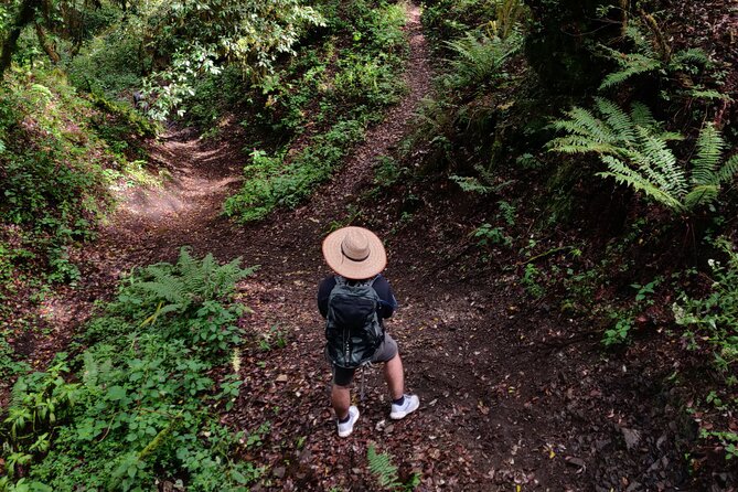
You should have moderate physical fitness and be comfortable walking on uneven mountain paths. This is not a sightseeing walk with occasional steps. The trail can involve repeated climbing and descending, and some sections have enough steepness to feel technical for less experienced hikers.
Hiking poles are supplied, which is helpful on descents and loose or uneven ground. Wear proper hiking footwear. Several people specifically found sturdy boots important, and that advice becomes even more important during the rainy season.
Pine, oak, fungi, and changing microclimates
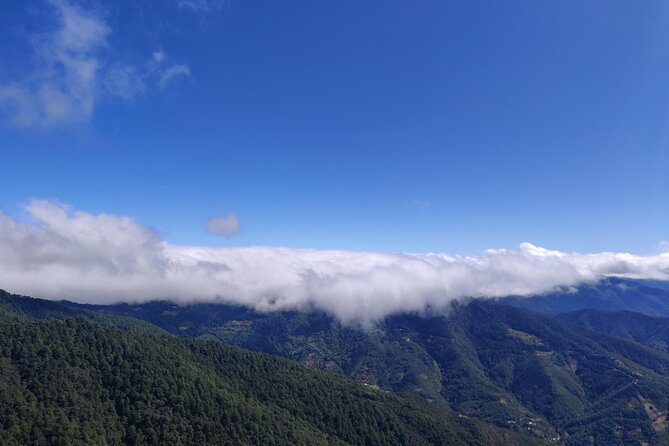
The Sierra Norte section visited here sits between 2,800 and 3,100 meters above sea level. That altitude shapes nearly everything: the temperature, the vegetation, the effort required, and the views.
You walk through pine-oak forest and across several microclimates. A microclimate is a small area with its own conditions, often shaped by slope, shade, moisture, and elevation. For you, that means the scenery keeps changing rather than repeating itself for the entire day.
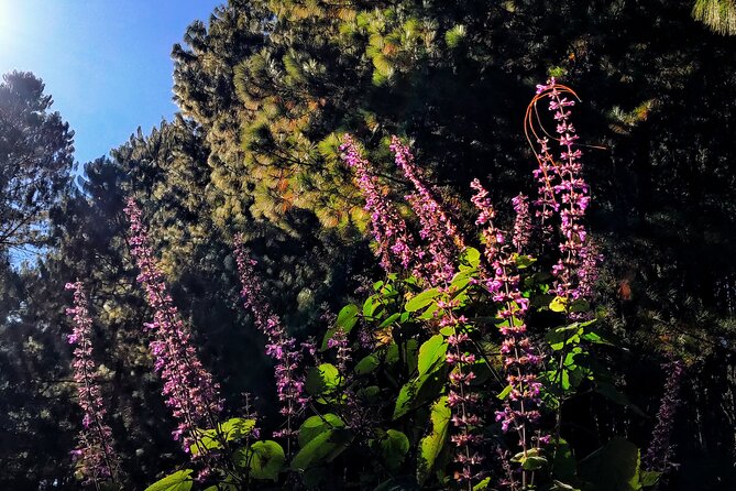
Luis Fernando adds meaning to what you see. He can explain local flora, fauna, fungi, and the traditional medicinal uses of plants. Several outings have included close looks at mushrooms, leaves, flowers, fruits, and unusual plants that some people know only from botanical gardens or greenhouses.
Mushrooms can become a special focus if you are interested. One route included collecting different varieties and having some prepared with the later meal. That is not something to assume will happen on every departure, but it shows how the outing can become more than a basic hike when the season and guide’s knowledge line up.
The guide’s natural-history explanations are one of the strongest reasons to choose this experience over walking alone. You get a better sense of how the communal villages use and care for the forest, and you begin to notice details you might otherwise pass without seeing.
Wildlife sightings are not guaranteed, but the forest supports plenty to discuss. Birds, plants, fungi, and the relationships between people and mountain resources become part of the walk.
A different sort of day out around Oaxaca:
- Hierve el Agua, Tule Tree, Mitla and Mezcal Distillery Tour
★ 4.5 · 1,094 reviews - Explore Hierve el Agua, Mitla, Tule, Textile and Mezcal for a day
★ 5.0 · 1,043 reviews - Monte Alban Guided Half Day Tour
★ 5.0 · 880 reviews - Oaxaca de Juarez: Monte Alban Half-Day Tour
★ 4.7 · 492 reviews
Views that reward the climbs
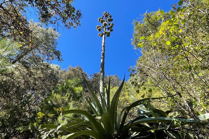
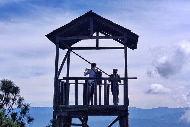
The most memorable sections tend to come after the work. Routes have reached viewpoints around 10,500 to 10,600 feet, or approximately 3,200 to 3,230 meters, according to individual accounts. The exact high point may differ by route, but the message is clear: you earn the views with your legs and lungs.
Some paths pass through open farmland and along dirt roads before reaching more compelling forest sections. This is worth knowing because the entire route is not likely to be postcard scenery. The early kilometers may feel ordinary, especially if you expected uninterrupted forest.
Later sections can be much more dramatic. Depending on the chosen route, you might cross rocky ground, pass through a narrow valley beside a fast-running stream, or reach a high viewpoint with broad mountain views. Rain, hail, cold, and shifting weather have all been part of different outings, so the experience is closely tied to the day’s conditions.
The altitude deserves respect. A fit person who lives at sea level may still need to slow down. One particularly useful account came from a very fit 71-year-old who found the elevation difficult but manageable with patience and careful pacing. That is the right attitude. You do not need to race, and the guide can offer choices, but you do need to accept that the mountains may set the pace.
How Luis Fernando handles different abilities
Luis Fernando receives the strongest praise in this experience. He is described as friendly, attentive, encouraging, and well informed about the region’s plants, animals, mushrooms, and customs. His English is considered strong, which helps if you want more than directions and trail warnings.
He also knows many connected trails, allowing him to adjust the route to the group. That flexibility can be a major advantage. A solo guest who was not very experienced still completed about 10 kilometers, while other groups received options to stop, continue, or choose another viewpoint.
The small group size helps, but it does not solve every pacing problem. If people with very different abilities join the same departure, faster hikers may need to wait and slower hikers may feel pressured. The guide aims to adjust the route, but you should speak up early about your comfort level rather than trying to keep up silently.
If you are traveling with a couple or group of friends, discuss your preferred distance before the hike begins. If one person wants 20 kilometers and another hopes for 3, this may not be the smoothest shared activity unless everyone is comfortable splitting the route or stopping early.
Dinner, trout, and mountain-town hospitality
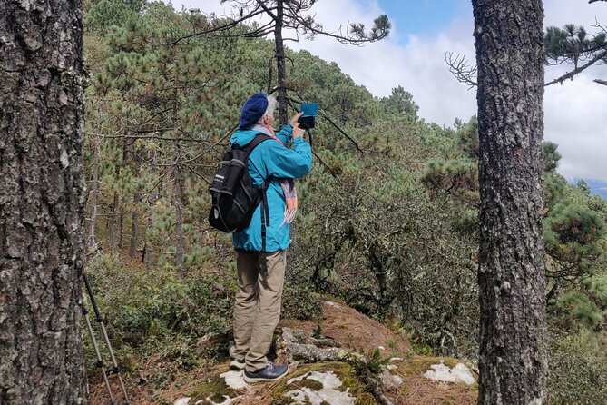
After the hike, you return to a local restaurant for a late lunch or early dinner. The meal is included, as are breakfast and trail snacks. The exact timing can be closer to 6 p.m., so anyone expecting a midday lunch should plan for a long gap between meals.
The food is a major part of the value. Several outings included fresh trout, with the fish prepared and cooked locally. In some cases, meals included mushrooms found along the route. Other descriptions emphasize hearty portions, family-run restaurants, and simple mountain cooking.
The food quality may vary by stop. One account found the final meal mediocre, though unlimited beer was appreciated. That is a fair reason to keep expectations sensible. You are choosing a local dining experience in a mountain community, not a polished restaurant tasting menu.
For me, that is still the right trade. Eating in two small community restaurants gives the day a human and local dimension that a standard park visit would miss. You see where people live, spend money with local businesses, and finish the hike with food that feels connected to the region.
The return drive brings you back to the original Oaxaca City meeting point. With transportation, entry fees, meals, snacks, water, poles, and a rain jacket included, you do not need to manage many extra costs during the day.
What to bring for the Sierra Norte
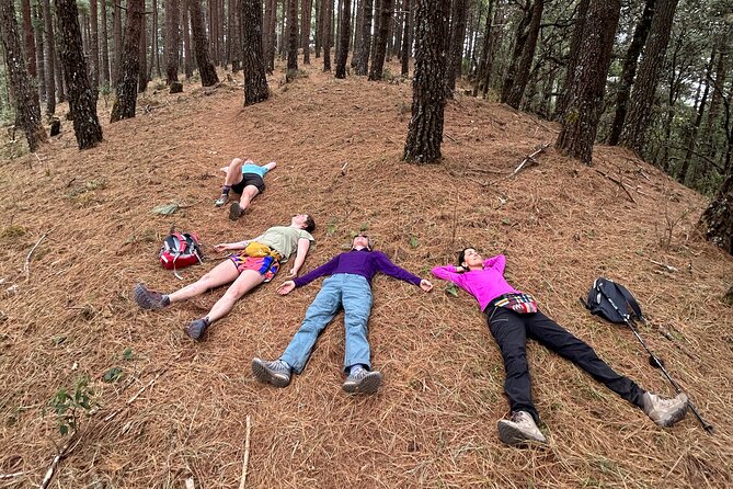
The mountain weather can be much colder and wetter than conditions in Oaxaca City. Pack for the high country, not the forecast you saw in the valley.
During the rainy season from June through October, bring hiking boots and a rain jacket. A rain jacket is included, and extra gear may be available, but your own waterproof footwear is still the safer choice.
During the dry season from November through May, bring:
- A long-sleeved shirt
- A hat
- Sunscreen
- Sturdy hiking footwear
- Warm clothing for the high elevation
A cold jacket is not included. That detail matters because several outings have felt cold, and high mountain weather can shift quickly. You also need to bring your own backpack. Water, refills, and trail mix are included, but you still need something to carry your personal layers and essentials.
The supplied trail mix, bottled water, refill water, hiking poles, and rain jacket make the day easier. An energy bar prepared by the guide’s brother has also been part of some outings. Those small touches are useful on a demanding route.
Is $161.30 a good value?
At $161.30 per person, this is not the cheapest way to see the mountains near Oaxaca. It is also more than a simple transport-and-walk outing.
The price includes private transportation for a 12-hour day, entry fees, breakfast, lunch or dinner, snacks, water and refills, hiking poles, and rain protection. It also buys a small group and a guide who can interpret the forest and change the route to fit the group.
I think the value is strongest if you would otherwise need to arrange mountain transport, meals, and a local guide separately. The two restaurant stops alone make the day feel like more than a paid transfer to a trailhead.
The value is weaker if you want a long, fast hike with an early start and tightly defined distance. The breakfast stop delays the trail, the route can change, and the first section may be harder than the short-distance label suggests.
The experience is recommended by 98 percent of customers and carries a 4.9 rating from 143 reviews, a strong record. I would still focus on the practical fit rather than the score. The people most likely to love this day are those who want nature, local food, cultural context, and a guide-led challenge.
Who should book this Oaxaca hiking day?
You should consider booking if you:
- Enjoy moderate to strenuous hiking
- Want to get above the heat and noise of Oaxaca City
- Like learning about plants, mushrooms, and local customs
- Prefer a small group and private transport
- Appreciate generous local meals
- Are comfortable with changing plans and mountain weather
- Want a full day rather than a short scenic walk
Think twice if you need a guaranteed easy route, have trouble with steep ground, dislike waiting for a mixed-ability group, or want to be back in Oaxaca early. The distance range is wide, and altitude can make a seemingly manageable route feel much harder.
Book at least a day ahead if possible. The experience is often reserved about 21 days in advance, suggesting that popular dates can fill early. Free cancellation is available when you cancel at least 24 hours before the 8 a.m. start.
Should you book Hiking in the Sierra Norte?
Book it if you want a mountain day with substance. The strongest reasons are Luis Fernando’s plant and forest knowledge, the changing high-altitude scenery, the communal-village setting, and the included meals at local restaurants.
Do not book it expecting a flat nature walk or a perfectly fixed 2 to 5 kilometer stroll. Ask about the expected first section, tell Luis Fernando your true fitness level, and bring warm layers and proper footwear.
For the right person, this is one of the better ways to experience Oaxaca beyond the city. You get fresh mountain air, demanding trails, local food, and a closer look at the communities and forests of the Sierra Norte, all in one long but worthwhile day.
FAQ
Where does the experience begin?
It begins at 8 a.m. at Dr. Liceaga 119, RUTA INDEPENDENCIA, Centro, Oaxaca de Juárez, Oaxaca.
How long does the experience last?
The full day lasts approximately 12 hours and ends back at the original meeting point in Oaxaca City.
How far is the hike?
The possible distances are described as short, 2 to 5 kilometers, intermediate, 5 to 12 kilometers, or long, 12 to 25 kilometers. The guide chooses the route based on the group’s abilities and pace.
How high does the hike go?
The hiking area sits at approximately 2,800 to 3,100 meters above sea level. Some outings have reached viewpoints around 10,500 to 10,600 feet.
What meals are included?
Breakfast and a later lunch or dinner are included. Trail mix, bottled water, and water refills are also provided.
What should I bring?
For June through October, bring hiking boots and a rain jacket. For November through May, bring a long-sleeved shirt, hat, and sunscreen. You should also bring a backpack and cold jacket, since those are not included.
How large is the group?
The maximum group size is eight people. A moderate level of physical fitness is required.
Just added around Oaxaca
- Oaxaca: Early Arrival at Hierve el Agua + Pickup + Admission★ 4.4 · 105 reviews
- Private Transportation from Oaxaca Airport to Hotel★ 4.5 · 107 reviews
- Art walk & Cacao delight★ 5.0 · 111 reviews
- Tule, Mitla & Hierve el Agua Full-Day Tour with Certified Guide★ 4.5 · 114 reviews
- Boil the Water, Mitla, Tule, Mezcal and more★ 4.0 · 118 reviews
- Small Group Boerve del Agua and Mezcal Tour from Oaxaca Centro★ 5.0 · 118 reviews
- Private Minivan: Huatulco International Airport (HUX)★ 4.0 · 119 reviews
- Street Art Bike Ride★ 5.0 · 125 reviews
Hiking & Trekking, compared.
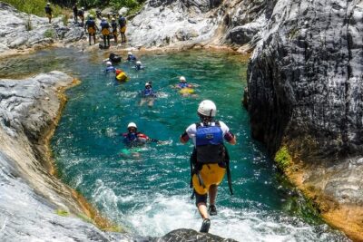
Matacanes : Canyoning + Hiking + Water Jumps + Rappel + Caves
Read our review →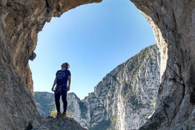
Nido de los Aguiluchos, Monterrey: Hiking + Rock Climbing + 3 Rappels
Read our review →
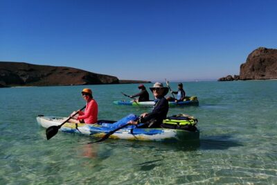
Balandra & Tecolote: hike, kayak and snorkel in paradise
Read our review →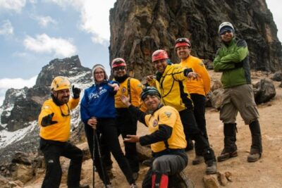
Browse the lists this tour appears in